The best beaches in Sri Lanka change with the season, because the two monsoons rain on opposite coasts. This guide covers 13: Negombo, Bentota and Hikkaduwa in the west; Unawatuna, Weligama, Mirissa, Hiriketiya and Tangalle in the south; Arugam Bay, Pasikudah, Nilaveli and Uppuveli in the east; and Kalpitiya in the north-west. According to the Department of Meteorology, the May to September south-west monsoon brings wetter conditions to the south-west. Its north-east monsoon, December to February, affects the island’s north-eastern parts (Department of Meteorology). Over the WMO’s 1991 to 2020 normals, the Galle station on the south coast gets under 100 mm a month only from January to March. On the east coast, Trincomalee and Pottuvil both stay below 100 mm in every month from March to August (WMO climate normals). We’re based in Weligama, a south coast town.
Key takeaways
- West and south coasts: January to March are Galle’s three months under 100 mm of rain, and Love Sri Lanka puts the south coast’s best time at December to March.
- East coast: Pottuvil, beside Arugam Bay, averages under 100 mm a month from March to September, and Trincomalee from February to August. Love Sri Lanka says April or May to September.
- Kalpitiya, in the north-west, has two answers: October to May for the beach on one Love Sri Lanka page, mid-May to September for kitesurfing winds on another.
- GOV.UK’s swimming advice, on a page last updated on 21 September 2026: “Many beaches in Sri Lanka have dangerous surf or rip tides at certain times of the year. Get advice from your hotel or tour operator before going in the sea.”
- Negombo is 12 km by road from the airport. Arugam Bay, the farthest beach here, is about 340 km.
Sri Lanka beaches at a glance
The WMO publishes 1991 to 2020 normals for 20 Sri Lankan weather stations. For each beach, the third column gives the months averaging under 100 mm of rain at the closest one (WMO climate normals). We measured the distances in straight lines from each file’s coordinates. Where two stations are about equally close, both appear. Dry weather is what “best” means here; the sea is a separate matter, covered further down.
| Beach | Coast | Best months for dry weather | Guide |
|---|---|---|---|
| Negombo | West | Jan, Feb, Jul, Aug (Katunayaka) | Love Sri Lanka |
| Bentota | West | Jan to Mar (Galle); Jan, Feb (Ratmalana) | Love Sri Lanka |
| Hikkaduwa | West | Jan to Mar (Galle) | Our guide |
| Unawatuna | South | Jan to Mar (Galle) | Our guide |
| Weligama | South | Jan to Mar (Galle) | Our guide |
| Mirissa | South | Jan to Mar (Galle) | Our guide |
| Hiriketiya | South | Jan to Mar (Galle); Jan to Aug (Hambantota) | Surf hub |
| Tangalle | South | Jan to Aug (Hambantota) | Love Sri Lanka |
| Arugam Bay | East | Mar to Sep (Pottuvil) | Our guide |
| Pasikudah | East | Mar to Sep (Batticaloa) | Love Sri Lanka |
| Nilaveli | East | Feb to Aug (Trincomalee) | Love Sri Lanka |
| Uppuveli | East | Feb to Aug (Trincomalee) | Love Sri Lanka |
| Kalpitiya | North-west | Jan to Mar, Jun to Sep (Puttalam) | Love Sri Lanka |
Which coast in which months
The Met Department splits the year four ways. Its south-west monsoon season covers May to September; the north-east monsoon runs through December, January and February. The first inter-monsoon falls in March and April, and the second in October and November, as its December 2023 newsletter lists them (Department of Meteorology).
Sri Lanka Tourism’s label for December to February on the south-west coast is peak tourist season. From May to September it points visitors to the dry zone, Trincomalee and Arugam Bay among the places it names. October and November bring occasional heavy showers everywhere, it says, and rough seas are possible (Sri Lanka Tourism).
Love Sri Lanka’s March 2024 beach guide picks December to March for south coast beaches, and April or May to September for the east (Love Sri Lanka). The stations show the swing. Galle averages 71 mm in February against 316 mm in May. Pottuvil, a few kilometres from Arugam Bay, gets 14 mm in June and 308 mm in November (WMO, Galle; WMO, Pottuvil). Our Sri Lanka weather by month page prints Galle, Nuwara Eliya and Trincomalee for all 12 months.
West coast beaches
Negombo
Love Sri Lanka puts Negombo 20 minutes from Bandaranaike International Airport and suggests it for the start or end of a trip (Love Sri Lanka). Wikivoyage is blunter: the airport is the town’s main draw, and the beaches are “quite dirty due to rubbish”. Still, it rates the long strip for an evening walk, when hundreds of local people fly kites (Wikivoyage).
Bentota
Wikipedia places Bentota on the southern bank of the Bentota River mouth, about 65 km south of Colombo (Wikipedia). Love Sri Lanka describes the town as having the ocean on one side and the river on the other, and lists jet skiing and river boat rides (Love Sri Lanka). OpenStreetMap draws two adjoining stretches named Bentota, and we measured each at about 2.7 km end to end (OpenStreetMap; OpenStreetMap).
Hikkaduwa
By Wikivoyage’s account, part of the beach lies inside Hikkaduwa National Park, a marine park. Its page, last edited in June 2026, calls the coral badly damaged but “kind of recovering”. Fines for harming it have been strictly enforced since 2025, it says, and feeding the turtles on Turtle Beach is no longer allowed (Wikivoyage). Wikipedia dates the national park to 19 September 2002 and describes a shallow fringing reef, about 5 m deep on average (Wikipedia). Love Sri Lanka recommends it for snorkelling, diving and nightlife (Love Sri Lanka).
South coast beaches
Unawatuna
Galle Fort is 6 km from the bay by road (route), and the map shows a single beach of about 1.3 km along its curve (OpenStreetMap). In June 2024 the Daily Mirror reported that a foreign national had died swimming off the beach; police said he was likely dragged out by rip currents (Daily Mirror). The Unawatuna beach guide sets out what the dated sources say about swimming there.
Weligama
Weligama’s sand appears on OpenStreetMap as three stretches adding up to about 4 km, twice the 2 km Love Sri Lanka gives (OpenStreetMap; Love Sri Lanka). Love Sri Lanka’s 2022 surf map describes small, predictable breaks catering mainly to novices (Love Sri Lanka). Wikivoyage warns of a current here that can be strong and unpredictable (Wikivoyage). This is our home bay, and the Weligama beach guide has its monthly weather and the 2026 swimming reports.
Mirissa
Love Sri Lanka’s beach guide calls Mirissa the south coast’s largest fishing port and lists whale and dolphin watching, surfing and snorkelling (Love Sri Lanka). Its whale page gives November to April as the season (Love Sri Lanka), and our Mirissa beach guide covers the bay itself.
Hiriketiya
Mondo Surf describes Hiriketiya as a small, horseshoe-shaped bay near Dikwella, about 21 km from Matara. It rates the main break, a left over boulders, for intermediate and advanced surfers and “not for beginners” (Mondo Surf). The Sri Lanka surfing guide compares it with 15 other spots.
Tangalle
Tangalle is a fishing port on one of the largest bays in Sri Lanka, enclosed by a reef, says Wikipedia. The same page puts Hummanaya, which it calls the island’s only blowhole, 11.2 km north of town (Wikipedia). Love Sri Lanka lists turtle watching at Rekawa and the Kalametiya bird sanctuary nearby (Love Sri Lanka). Its beach guide pitches Tangalle for lazy days, lagoons and mangroves rather than water sports (Love Sri Lanka).
East coast beaches
Arugam Bay
Surfers come from April to October, Wikivoyage says, and July and August are the busiest months, with the best waves. From November to March the wet season stops surfable waves forming, and most hotels and restaurants shut (Wikivoyage). Love Sri Lanka names Main Point and Whisky Point among the breaks and mentions surf schools for learners (Love Sri Lanka). The town itself is in our Arugam Bay guide.
Pasikudah
Pasikudah is a resort town 35 km north-west of Batticaloa, beside Kalkudah. Wikipedia, in an article it flags as resting on one source, says it has one of the world’s longest stretches of shallow reef coastline (Wikipedia). OpenStreetMap’s Pasikudah Beach measures about 2.2 km end to end (OpenStreetMap). Love Sri Lanka lists kitesurfing and snorkelling (Love Sri Lanka). Of Batticaloa, Wikivoyage’s page (edited on 19 October 2026) says the city’s beaches lack a protective reef and are not suitable for swimming (Wikivoyage).
Nilaveli, Uppuveli and Pigeon Island
Nilaveli lies 16 km north-west of Trincomalee, with Pigeon Island National Park 1 km off its coast (Wikipedia). OpenStreetMap draws Nilaveli Beach as one stretch, about 8.6 km end to end (OpenStreetMap). According to Wikipedia, the island became a sanctuary in 1963 and a national park in 2003, and uncontrolled tourism has degraded its reef (Wikipedia). Wikivoyage’s Trincomalee page, edited on 9 October 2026, goes further: most of the island’s coral reef had been killed as of 2025 (Wikivoyage). Its Nilaveli page, edited two days later, calls the beach no good for swimming during the monsoon, December to March (Wikivoyage).
Uppuveli is about 3 km north of Trincomalee town. Wikivoyage reports plastic washing up on these beaches, with clean-ups only in the high season, and recommends the dry months of April to September (Wikivoyage).
North-west coast: Kalpitiya
Kalpitiya is a peninsula of 14 islands in Puttalam District. Love Sri Lanka calls it the best place in Sri Lanka for kitesurfing, and popular for snorkelling, diving and dolphin trips too. The same page gives October to May as the best time for the beach (Love Sri Lanka). Its watersports page says the kitesurfing winds peak from mid-May to the close of September (Love Sri Lanka). Wikivoyage also has the kite season running from May to September, and diving from December to April (Wikivoyage).
Swimming: what the official advice says
When we read GOV.UK’s Sri Lanka page on 21 October 2026, it showed 21 September 2026 as the latest change and was marked as still current (GOV.UK). Its “Swimming safety” section links to a Royal Life Saving Society page on holiday water safety. The advice itself: “Many beaches in Sri Lanka have dangerous surf or rip tides at certain times of the year. Get advice from your hotel or tour operator before going in the sea.” (UK Foreign Office).
In a news item of 1 May 2026, the Coast Guard counted sixteen lifesaving posts along beaches that draw tourists, and named none of them (Sri Lanka Coast Guard). A map on its lifesaving page, with no date on it, shows 18 dots. For beaches on this page the labels read Benthota (three dots), Hikkaduwa, Unawatuna, Mirissa, Pasikuda (three) and Nilawali. None is labelled Negombo, Weligama, Hiriketiya, Tangalle, Arugam Bay or Kalpitiya (Sri Lanka Coast Guard). We found nothing on whether or when any post is staffed, so a dot on the map can’t tell you a lifeguard will be on duty the day you visit.
Getting to the beaches
On 21 October 2026 we routed each drive from Bandaranaike airport with the OpenStreetMap planner. It ignores traffic, so the times below are its results rounded up.
| From the airport to | Distance | Usual time |
|---|---|---|
| Negombo | 12 km (directions) | 20 to 30 minutes |
| Bentota | 109 km (directions) | 1 hour 45 to 2 hours 15 |
| Hikkaduwa | 141 km (directions) | 2 to 2.5 hours |
| Unawatuna | 158 km (directions) | 2.5 to 3 hours |
| Weligama | 171 km (directions) | 2.5 to 3 hours |
| Mirissa | 176 km (directions) | 2.5 to 3 hours |
| Hiriketiya | 204 km (directions) | 3 to 3.5 hours |
| Tangalle | 211 km (directions) | 3 to 3.5 hours |
| Kalpitiya | 137 km (directions) | 3 to 3.5 hours |
| Uppuveli | 235 km (directions) | 4.5 to 5.5 hours |
| Nilaveli | 244 km (directions) | 5 to 6 hours |
| Pasikudah | 264 km (directions) | 5 to 6 hours |
| Arugam Bay | About 340 km (directions) | 6 to 7 hours |
Our airport transfers page gives shorter figures for some areas, such as 88 km and 1 hour 30 minutes for Bentota. The router makes our Bentota point 109 km and 1 hour 32 minutes on empty roads.
Sri Lanka Railways lists Coast Line stations at Bentota (61 km from Colombo Fort), Hikkaduwa (95 km), Unawatuna (120 km), Weligama (143 km) and Mirissa (148 km). Negombo is 39 km out on the Puttalam line, and Trincomalee station ends its own line at 297 km (Sri Lanka Railways). Around Arugam Bay there are no stations at all, says Wikivoyage (Wikivoyage).
For a beach outside Sri Lanka, our Sri Lanka and Maldives tour (Serenity of Ceylon on its page) adds three Maldives nights to seven in Sri Lanka. Its page puts the Colombo to Male flight at about an hour and says the route skips southern Sri Lanka.
Questions about Sri Lanka’s beaches
Which is the best beach in Sri Lanka?
No single one, and we don’t rank them. Named sources do say what some are best for. Love Sri Lanka calls Kalpitiya the country’s best place for kitesurfing (Love Sri Lanka), and for beginner surfers Wikivoyage’s pick is Weligama (Wikivoyage). Choose the coast that suits your months first, from the table above.
When is the best time for a beach holiday in Sri Lanka?
On the west and south coasts, Galle’s only months under 100 mm are January, February and March (WMO, Galle). On the east coast, Pottuvil stays under 100 mm from March to September (WMO, Pottuvil). October and November, the Met Department’s second inter-monsoon, fall between the two.
Which beaches in Sri Lanka are safe for swimming?
We found no official list of safe beaches. GOV.UK’s advice is for the island as a whole, not beach by beach: “Many beaches in Sri Lanka have dangerous surf or rip tides at certain times of the year. Get advice from your hotel or tour operator before going in the sea.” (UK Foreign Office). An undated Coast Guard map marks lifesaving posts at some of the beaches above, and we found nothing on whether or when any is staffed.
Which beach is closest to Colombo airport?
Of the 13 here, Negombo: 12 km away by road, usually a 20 to 30 minute drive (route).
Plan a beach trip from Weligama
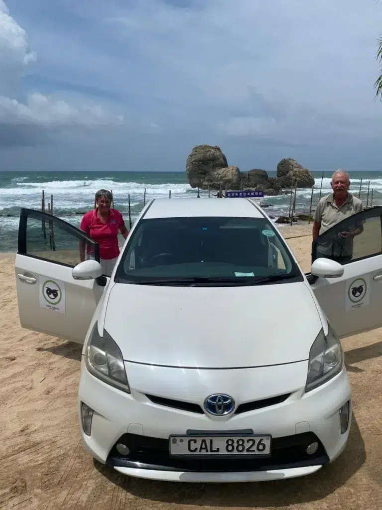
What we arrange from Weligama is the driving: one private car and driver for the whole route, from your arrival at the airport to the flight home. Send your travel months and the beaches you’re considering through our contact page, and we’ll say which side of the island fits those dates.
Station averages, map measurements and routes were worked out, and every linked page read, on 20 and 21 October 2026. Rain averages describe a typical year rather than your week, and the sea can change from one day to the next.