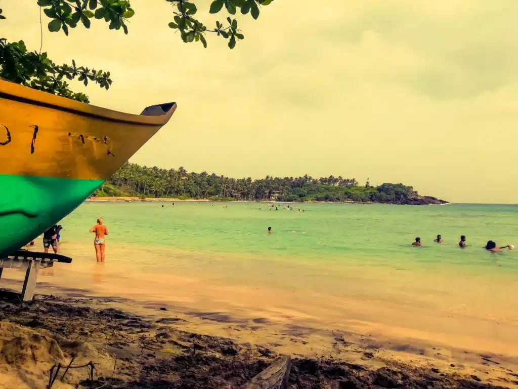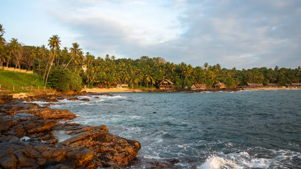
Mirissa beach is a curve of sand in a small fishing town on Sri Lanka’s south coast (Wikipedia). OpenStreetMap draws it 1.2 km from end to end, with Parrot Rock on its eastern half and the fisheries harbour 500 m to the north-west (beach; harbour). It is 176 km by road from Colombo’s airport (route). Love Sri Lanka, the tourism bureau’s site, names November to April as the season for whales and snorkelling (whales; snorkelling). In GOV.UK’s advice, updated 21 September 2026, many beaches on the island have rip tides or dangerous surf at some times of year. Check with your hotel or a tour operator before you enter the sea, it says (GOV.UK).
Key takeaways
- The mapped beach is 1.2 km in a straight line and about 1.4 km along the curve. Secret Beach, the harbour and Coconut Tree Hill each lie about half a kilometre or less beyond its ends.
- Dated reports describe people caught in currents here: rescues in 2022, 2023, October 2025, January 2026 and September 2026, and a drowning on 25 December 2025. No source we found says when lifesavers are on the beach.
- GOV.UK’s swimming advice (page updated 21 September 2026), quoted in full below, names dangerous surf and rip tides as seasonal hazards on many Sri Lankan beaches. It asks you to get advice from a hotel or tour operator before a swim.
- Galle, the nearest station with 30-year weather records, is driest from January to March and wettest in October.
- Mirissa station is on the Coast Line, but 1.9 km from the sand.
Where is Mirissa beach?
The town sits on the A2 highway between Colombo and Wellawaya, and Wikipedia calls it the south coast’s biggest fishing port (Wikipedia). Its first tourist accommodation went up in 1980, and tourism grew sharply from the mid-1990s. The 2004 tsunami destroyed or damaged many homes, guesthouses, schools and temples, and fourteen deaths were reported (Wikipedia).
Weligama is 5 km west by road (route) and Galle Fort 33 km (route). If you’re torn between the two bays as a base, our Weligama or Mirissa comparison sets them side by side, and the Weligama beach guide covers the longer bay to the west.
The bay on the map: harbour, Parrot Rock and Coconut Tree Hill
We measured the bay on OpenStreetMap on 21 October 2026. The beach outline runs 1.20 km between its ends and about 1.38 km following the shore (OpenStreetMap). The table runs from west to east.
| Feature | What the map shows | Distance from the main sand |
|---|---|---|
| Secret Beach | A cove about 120 m long, south of the harbour (map) | 430 m from the western end |
| Mirissa Fisheries Harbour | The fishing harbour (map) | 500 m |
| Surf spots | Two marked on the bay: at the western end and beside Parrot Rock (west; Parrot Rock) | At the water’s edge |
| Parrot Rock | An islet whose outline touches the beach’s (map) | Joined to the sand |
| Coconut Tree Hill | A viewpoint on the headland (map) | 415 m beyond the eastern end |
All distances are straight lines from the nearest point of the sand. The map also marks a “Big Wave” surf spot off Coconut Tree Hill (OpenStreetMap), and another further east at Thalaramba (OpenStreetMap). A volunteer map isn’t a survey, so treat these as what people have drawn.
Parrot Rock’s 2020 page on Love Sri Lanka calls it a small rocky outcrop with views along the palm-lined coast. Coral has grown over the smaller rocks around it, the page says (Love Sri Lanka). The same site’s 2024 beach guide lists whale and dolphin watching, surfing, jet skiing and snorkelling at Mirissa (Love Sri Lanka).
Can you swim at Mirissa beach?
We found no official source that rates this beach for swimming.
Love Sri Lanka’s Parrot Rock page, published in 2020, advises against swimming by the rock when the tide is high or the season is over, because the water can turn quite rough (Love Sri Lanka).
The Sri Lanka Coast Guard reported that on 19 September 2022 lifesavers from its Mirissa post rescued four foreigners being dragged away by currents near the beach (Sri Lanka Coast Guard). On 2 August 2023, it said, the same post’s lifesavers rescued three more people bathing there. That release called sea conditions on the western and southern coasts unfavourable for bathing at the time, citing large waves, sudden swells and heavy currents (Sri Lanka Coast Guard).
More recent reports cite police. Newswire wrote on 24 October 2025 that four foreign tourists caught in a strong current at Kotawila, in the Mirissa police area, were rescued by police lifeguards (Newswire). Ada Derana reported that a 49-year-old doctor died after drowning at Mirissa Beach on 25 December 2025. Local residents rescued him, the report said, and he died later at Matara General Hospital (Ada Derana). On 11 January 2026, Newswire reported, a 65-year-old foreign national caught in a strong current at Mirissa beach was brought ashore by the Kotawila Police Lifeguard Unit (Newswire). The newest report we found is from 20 September 2026: officers of the Mirissa Police Lifesaving Unit had rescued a 30-year-old tourist caught in a strong current off Mirissa the day before (Newswire). Our searches found these; the list is not complete.
On 1 May 2026 the Coast Guard said it runs 16 lifesaving posts on key tourist beaches, without naming them (Sri Lanka Coast Guard). On its lifesaving page, a map with no date shows 18 dots, one labelled Mirissa (lifesaving page). The latest dated Coast Guard release we found that names its Mirissa post is the one from August 2023. None of these sources gives hours, or says on which days a Coast Guard post or police unit is staffed.
GOV.UK still listed its Sri Lanka advice as current when we read it on 21 October 2026, and the last update was dated 21 September 2026. Its “Swimming safety” section, complete: “Many beaches in Sri Lanka have dangerous surf or rip tides at certain times of the year. Get advice from your hotel or tour operator before going in the sea.” One more line names the Royal Life Saving Society as a source of tips on swimming abroad (GOV.UK). We have nothing to add to it.
When to go to Mirissa
Neither Mirissa nor Weligama has a weather station with 1991 to 2020 normals. Galle’s is the nearest, 28 km west in a straight line. Its rain is lowest from January to March, between 71 and 90 mm a month on six or seven rain days. The wettest month is October, at 345 mm, followed by May at 316 mm (WMO climate normals).
December to February, the north-east monsoon, is peak season on the south-west coast according to Sri Lanka Tourism. It describes May to September, the south-west monsoon, as a time of heavy rain there (Sri Lanka Tourism). Love Sri Lanka’s Mirissa pages give November to April for whale trips, Parrot Rock and Secret Beach (whales; Parrot Rock; Secret Beach). For the whole island month by month, see Sri Lanka weather by month.
Things to do in Mirissa
Coconut Tree Hill
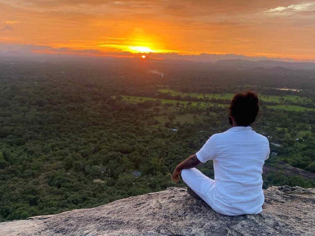
Love Sri Lanka puts the hill 15 minutes’ walk from the beach. You can walk along the sand, or get dropped on the main road and climb for about two minutes. It gets more crowded at sunset (Love Sri Lanka). The map’s walking router makes it 1.3 km from the middle of the beach, about 17 minutes (route).
Secret Beach
Love Sri Lanka’s 2020 page divides Secret Beach into three: Blue Lagoon, a tidal rock pool; Palm Cove, for snorkelling; and Shelly Beach, a set of rock pools with a blowhole. The walk in, it says, crosses jungle and a village (Love Sri Lanka). On foot it’s 1.7 km from the middle of the main beach, about 25 minutes (route).
Turtle Bay and snorkelling
Turtle Bay isn’t named on the map. Love Sri Lanka’s 2020 page says snorkelling there works only at low tide and is best from January to April. It adds that turtles nest along the coast between Unawatuna and Mirissa (Love Sri Lanka). Wikivoyage’s Mirissa page, last edited in August 2026, reports “very damaged” coral, though with plenty of fish and an occasional turtle (Wikivoyage).
Two listings we read on 21 October 2026 show what is sold here. Diving Mirissa’s PADI listing offers fun dives, courses and snorkelling, with daily boat dives to reef and rock sites, open 8am to 8pm every day (PADI). A two-hour turtle snorkel at Mirissa Beach on Civitatis was priced from US$25, with an English-speaking instructor and no under-12s (Civitatis). These are listings, not our judgement, and we rank nobody. More trip listings, and the rules on turtles and coral, are in our Weligama snorkeling guide.
Whale watching
On Love Sri Lanka’s whale page, the season is November to April, with boats leaving the dock by 6am. It is clear that no sighting can be promised, in season or not (Love Sri Lanka). What the boats charge, when they leave and the rules on how close they may go are in our Mirissa whale watching guide.
The harbour is a 1.2 km walk from the middle of the beach, about 16 minutes (route). Newswire reported on 1 May 2024 that the Cabinet had approved a proposal to make the Mirissa marine zone a Blue Flag coastal zone and a marine wildlife sanctuary (Newswire). Blue Flag’s own report of the programme’s Sri Lankan launch, in October 2024, names Mirissa as one of five pilot beaches (Blue Flag). We found no report of a declaration or an award, so treat both as plans.
Surfing
Love Sri Lanka’s 2022 surf map says Mirissa’s big breaks need skill and confidence, with a November to March season (Love Sri Lanka). Sources rate the spots differently: our guide to surfing in Sri Lanka puts them side by side, with the tide warnings for Mirissa’s reef.
Getting to Mirissa
Each leg below comes from OpenStreetMap’s route planner, run on 21 October 2026. Because it expects clear roads, every time is rounded up.
| Starting point | Distance on the planner | Usual time by car |
|---|---|---|
| Colombo airport | 176 km | 2.5 to 3 hours |
| Colombo Fort | 146 km | 2.5 to 3 hours |
| Galle Fort | 33 km | 45 minutes to an hour |
| Unawatuna | 27 km | 35 to 50 minutes |
| Weligama | 5 km | 10 to 15 minutes |
| Udawalawe | 110 km | 2 to 2.5 hours |
| Ella | 179 km | 3.5 to 4.5 hours |
The planner’s own time for the airport leg is 2 hours 22 minutes. The Mirissa and Weligama row on our airport transfers page reads 175 km and 2 h 40 m, which sits inside the range above.
By train
Sri Lanka Railways lists Mirissa station on the Coast Line, 147.6 km from Colombo Fort and 33.7 km beyond Galle, with Polwathumodara just before it (Sri Lanka Railways). The station is 1.9 km as the crow flies from the closest point of the sand (OpenStreetMap), and 2.8 km on foot to the middle of the beach (route). Wikivoyage suggests the train to Weligama instead, then a tuk tuk (Wikivoyage). We can’t give train times. On 21 October 2026 the railway’s timetable page carried an upgrade notice, not times (Sri Lanka Railways).
By bus and tuk tuk
Wikivoyage’s route is an air-conditioned highway bus to Matara, then one of the regular buses towards Weligama or Galle, which stop in Mirissa after 20 to 30 minutes. It names two stops: the first where the road reaches the bay, for beach stays, and one 1 km further on for the harbour (Wikivoyage). The National Transport Commission’s fares in force from 6 July 2026 put Colombo to Matara at Rs 681 on an ordinary bus, Rs 1,022 semi-luxury and Rs 1,320 air-conditioned. The expressway bus between the two is also Rs 1,320 (NTC; NTC expressway). Those are fares to Matara: the tables give no separate Mirissa fare.
Wikivoyage adds that the town is small enough to walk, and that tuk tuk drivers are known for trying to overcharge (Wikivoyage). For buses, tuk tuks and road safety, read GOV.UK’s own transport advice on its safety page as well (GOV.UK).
Where to stay at Mirissa, by part of the bay
| Part of the bay | On the map and in Wikivoyage | Our view: who it suits |
|---|---|---|
| West, by the harbour | The harbour and Secret Beach (map), and a bus stop for the harbour (Wikivoyage) | Early whale boats |
| Middle | Rows of guest houses and restaurants between the sand and the A2 (OpenStreetMap) | First visits, without a car |
| East | Parrot Rock, Coconut Tree Hill and the Big Wave spot (OpenStreetMap) | Surfers and sunset walks |
Past the headland, the map shows Thalaramba as a separate village, under 1 km east of Coconut Tree Hill (OpenStreetMap).
Our day trips on this stretch of coast
Two of our day trips begin with a morning pick-up from your hotel.
The Snorkling Excursion page (spelt that way) lists snorkelling with turtles in Mirissa, Coconut Tree Hill and Koggala’s stilt fishermen. It adds that it can’t promise you’ll see a fish caught. Our Galle day tour page describes a Madu River boat trip, a turtle hatchery and Galle Fort. Both pages carry the current price.
Questions about Mirissa beach
Is Mirissa beach safe for swimming?
We found no official rating for it. The Coast Guard and the police have reported rescues of people caught in currents here in 2022, 2023, 2025 and 2026, most recently in September 2026 (Coast Guard; Newswire), and a man drowned in December 2025 (Ada Derana). GOV.UK’s advice, updated 21 September 2026, says surf and rip tides make many of the country’s beaches hazardous in some seasons, and that you should take your hotel’s or tour operator’s advice before going in (travel advice).
How far is Mirissa beach from Colombo?
By road it’s 146 km from Colombo Fort (route) and 176 km from the airport (route), usually 2.5 to 3 hours from either. By rail, Mirissa station is 147.6 km from Colombo Fort (Sri Lanka Railways).
When is the best time to visit Mirissa beach?
At Galle, January to March is the driest stretch of the year (WMO climate normals). Love Sri Lanka’s whale page names November to April for whale watching (Love Sri Lanka).
How many days do you need in Mirissa?
We’d allow two nights. In the whale season, November to April, that gives you one early morning for a boat and a day for the beach, Parrot Rock and Coconut Tree Hill. Add a third for Galle or a snorkelling trip.
Plan Mirissa with a driver from Weligama
We’re based in Weligama, the next bay west, and what we arrange is private: transfers from the airport, day trips and longer routes with your own car and driver-guide. To fit Mirissa into a trip, send us your dates and where you plan to stay.
We read each source and measured the map and the routes on 21 October 2026. The sea, lifesaving posts, fares and the railway’s timetable all change, so check them again before you go.